-------------------------------------------------------------------------------------------
|
|
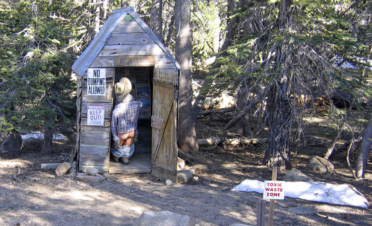
| July 1, 2006: I had driven up to the area of Carson Pass to do some training for the Death Ride the following weekend, and was looking for a place to park the Fed for the night. On the east side of Carson Pass off of Highway 88 is the road to Blue Lakes. Although I did not park there for the night, I did happen upon someone's "artistic" creation... worth a pic.
Route: East from Carson Pass on Highway 88 > Left on Highway 89 to South Lake Tahoe over Luther Pass (7,300') > South Lake Tahoe to Route 207 to Daggett Pass (7,334') > and down the Kingsbury Grade to Foothill Rd (206) and back up to Dagget > and back and right on Foothill to Fredericks Rd > to Emigrant Rd > to Highway 88 up through Hope Valley back to Carson Pass > and down the west side past Caples Lake to Carson Spur (7,990') > and back to Carson Pass . Distance: 105 miles. |
In and around Carson Pass 1 - 2 - 3 - 4 - 5 - 6 - 7 - 8
-------------------------------------------------------------------------------------------
Introduction | Climb to Cherry Lake | Climb to Carson Pass | Climb to Sonora Pass | Carson/Dagget/Carson/Carson Spur