-------------------------------------------------------------------------------------------
|
|
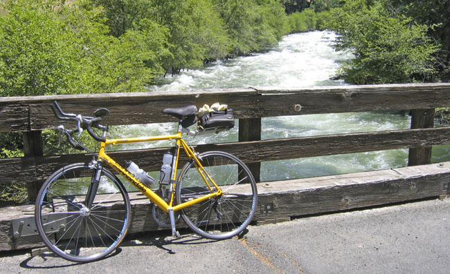
| June 6, 2006: The infamous Cherry Lake Road loop. Very challenging with steep climbs and descents... and very limited water/provision stops between Groveland and Tuolumne City... and no cell service. The pic above was taken at the lowest point of Cherry Lake Road where it crosses the Tuolumne River below the Shaughnessy Dam of Hetch Hetchy Reservoir. From here the road climbs to about 5,000 feet overlooking Cherry Lake.
Route: Knights Ferry > follow 120 at Yosemite Junction > New Priest Grade to Groveland > left on Cherry Lake Road > Tuolumne Road tthrough Tuolumne City to Sonora > 108 back to Knights Ferry. Distance: 133 miles. |
Tuolumne River 1 - 2 | Cherry Creek 1 - 2
-------------------------------------------------------------------------------------------
Introduction | Climb to Cherry Lake | Climb to Carson Pass | Climb to Sonora Pass | Carson/Dagget/Carson/Carson Spur